- Trainer/in: Hande Erdem
- Trainer/in: Zofia Pawlak
- Trainer/in: Gabriele Leoni
- Trainer/in: Maja Mauko
- Trainer/in: Zofia Pawlak
- Trainer/in: Martin Puhar
- Trainer/in: Krzysztof Zych
- Trainer/in: Željko Bačić
- Trainer/in: Gabriele Leoni
- Trainer/in: Zofia Pawlak
- Trainer/in: Vesna Posloncec-Petric
- Trainer/in: Krzysztof Zych
The course will focus on the use of Copernicus EO data and services to assess the landslide risk affecting the volcanic tuff slope on which the Baia Roman Thermae are built on. The Persistent Scatterers processing allows to perform ground displacement analysis focused on the detection of historical and recent landslides, thus helping technicians and site managers to properly address mitigation actions for the best conservation of Cultural Heritage.
The Roman Thermae of Baia are located in Bacoli municipality (Naples), close by the Phlegrean Fields caldera, representing a unique example of volcanic-related bradyseism with unrest cycles characterized by intense ground uplift and sinking
The particular location of the site, along the steep internal slopes of the volcano, required the use over time of massive terracing works. Preliminary InSAR analysis were performed exploiting ERS (1992-2000) ENVISAT (2003-2010) and COSMO Sky-Med (2011-2013) datasets; the first dataset show ground lowering phenomena affecting areas close to Phlegrean Fields during the period 1993–2003. InSAR data processing will take into consideration COSMO Sky-Med datasets and the most recent SENTINEL-1 data, allowing to assess the instability phenomena evolution of the area in a recent time interval.
- Trainer/in: Gabriele Leoni
- Trainer/in: Zofia Pawlak
- Trainer/in: Krzysztof Zych
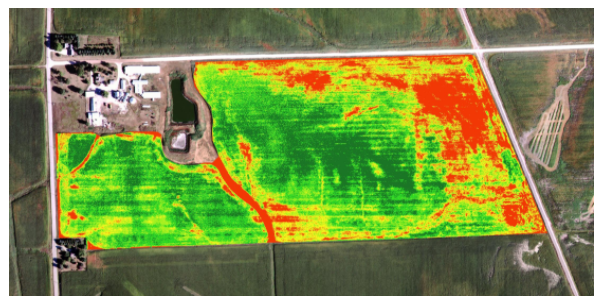
This webinar has the overall objective to promote the new opportunities offered by the Copernicus Programme in dealing with the Common Agricultural Policy (CAP).
The webinar is addressed to farmers, farmers’ organizations and citizens interested in the development of possible future workforce in this sector and in general in Earth Observation/Geospatial applications.
The EU Commission has indeed encouraged Member States for the use of Earth Observation (EO) technologies, especially for monitoring in a continuous way the correct payment of all declared areas for aid.
This initiative arises in the context of the EO4GEO project. Participants will be addressed on how to use EO*GI in the agricultural domain, exploiting the opportunity to access to free training data.
- Trainer/in: Massimo Antoninetti
- Trainer/in: Mariano Bresciani
- Trainer/in: Claudia Giardino
- Trainer/in: Mario Angelo Gomarasca
- Trainer/in: Gabriele Leoni
- Trainer/in: Zofia Pawlak
- Trainer/in: Krzysztof Zych
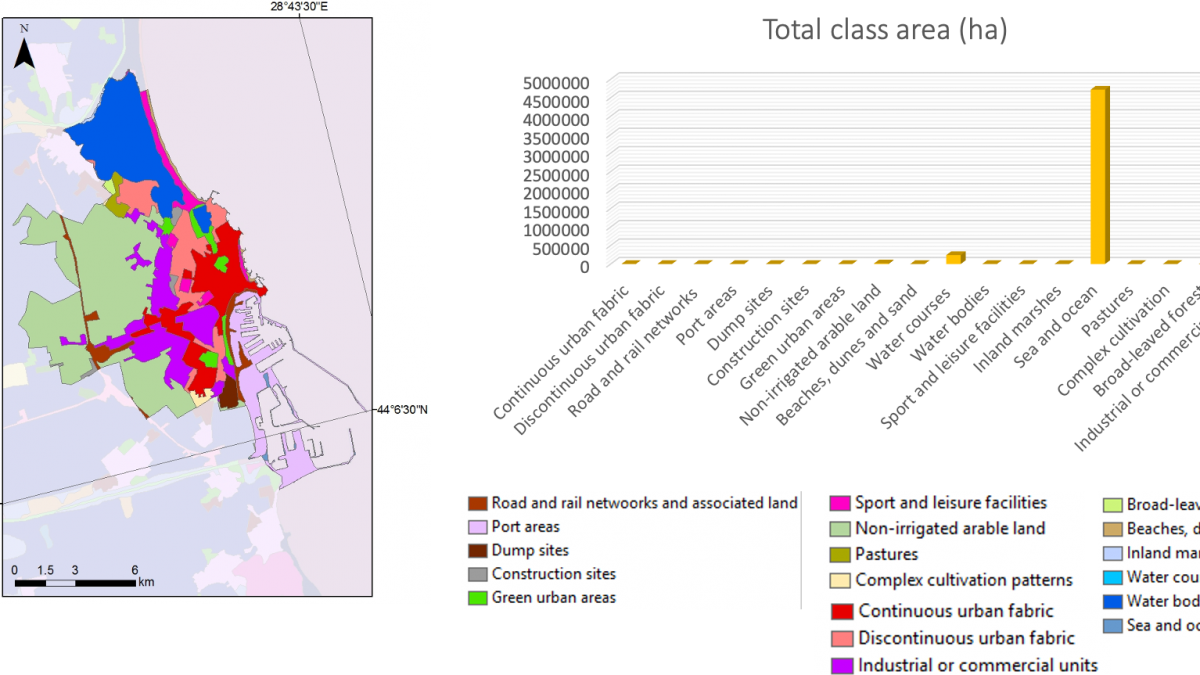
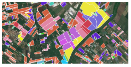
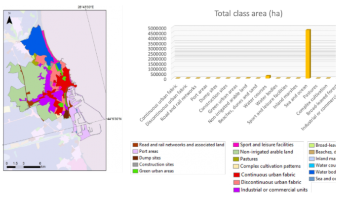
The lecture explain resolution characteristics of remote sensing data in general and of Copernicus Sentinel 1 and 2 in particular, focusing on operating principles of passive and active satellites. There are identified changes during 10 years period by using a quantitative analysis on land use and land cover.
- Trainer/in: Gabriele Leoni
- Trainer/in: Ion Nedelcu
- Trainer/in: Zofia Pawlak
- Trainer/in: Ioana Vlad
- Trainer/in: Krzysztof Zych
This webinar addresses the use of AI algorithms in EO applications. Participants will become familiar with AI concepts, from machine to deep learning, from unsupervised to supervised methods. Furthermore, applications in object detection, semantic segmentation, classification, clustering, and data augmentation will be showed.
This webinar is developed within the “Integrated Aplications task in the EO4GEO project.
The basic idea of AI algorithms (random forest, Multi-Layer Perceptron, Convolutional Neural Networks, and Generative Adversarial Networks) and how they are useful in the EO applications will be presented.
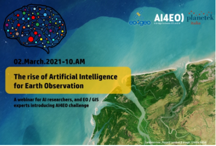
During the webinar, the AI4EO Project Team would like to introduce the AI4EO initiative and announce the launch of its first official Challenge. AI4EO is an initiative of the European Space Agency’s Φ-lab that aims to bring the worlds of Artificial Intelligence (AI) and Earth Observation (EO) closer together, stimulating and fostering new interaction and collaboration along the way.
The webinar is mainly non-technical, and all AI researchers, EO experts, GIS technicians, and technology enthusiasts are invited.
- Trainer/in: Daniela Iasillo
- Trainer/in: Gabriele Leoni
- Trainer/in: Zofia Pawlak
- Trainer/in: Krzysztof Zych
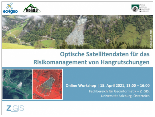
The workshop represented one of the training actions about Integrated Applications in the EO4GEO project.
During the workshop, we presented and discussed the research approach and preliminary results from the MontEO project. MontEO employs EO data to assess the impact of mass movements on infrastructure for the particular case of alpine trails and huts.
The workshop aimed for knowledge exchange: beyond giving practitioners an insight in state of the art EO methods for landslide mapping and modelling, researchers gained a better understanding of landslide risk management and its information needs.
- Trainer/in: Florian Albrecht
- Trainer/in: Gabriele Leoni
- Trainer/in: Zofia Pawlak
- Trainer/in: Krzysztof Zych
The first EO4GEO Training Action will be a presential workshop to be held on the 18th of November of 2020 in the ESTCE, Universitat Jaume I, Castellò de la Plana, Spain.
In this workshop, we will introduce students and teachers interested in Agriculture degree, the latest developments in emerging technologies such as geospatial technologies, Geographic Information Systems or Internet of Things (IoT) applied to agriculture and, above all, will introduce the Copernicus program, Earth Observation data, and the possibilities it opens up for future graduates.
At the end of the session, we will have the opportunity to discuss these issues.
- Trainer/in: Estefanía Aguilar
- Trainer/in: Carlos Granell
- Trainer/in: Gabriele Leoni
- Trainer/in: Zofia Pawlak
- Trainer/in: Krzysztof Zych