Webinar: Active fire detection with Sentinel-3 (SERCO)
Section outline
-
A webinar promoted by EO4GEO | 28 October 2021 at 14:30-16:00 CEST
Organizers: Serco UK&E
Language: English
Teachers:
- Tereza Roth, Remote Sensing Scientist at Serco
-
A series of four initial deadly wildfires erupted across central Portugal in the afternoon of 17 June 2017 within minutes of each other. An intense heat wave preceded the fires, with many areas of Portugal seeing temperatures in excess of 40 °C (104 °F). During the night of 17–18 June, 156 fires erupted across the country, particularly in mountainous areas 200 km (120 mi) northeast of Lisbon. Portugal’s fires have burnt 520,000 hectares of forest this year, 52 times the size of Lisbon and representing nearly 60 % of the total area burnt in the entire European Union in 2017. The amount of land burnt is the highest ever in Portugal's history.
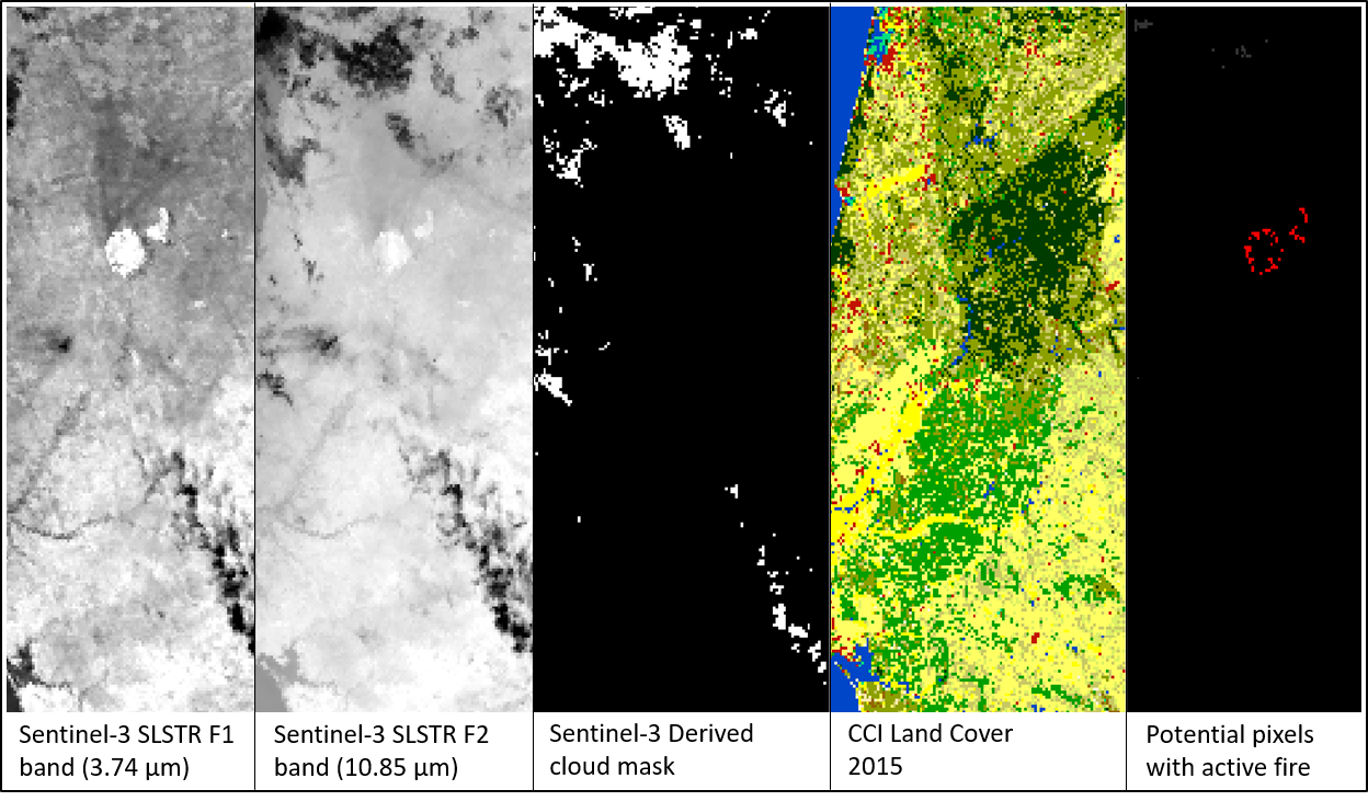
The purpose of this webinar is to focus on the basics of image processing for active fire detection, showing how to download, process, analyze and visualize the free data acquired by the Copernicus satellites. We will use the ESA SNAP Sentinel-3 Toolbox to demonstrate the methodology to detect active fires with the SLSTR instrument onboard Sentinel-3. As the result actively burning areas can be detected faster in real-time. As data is freely available, the method proposed is cost-effective method which can be applied to any areas where the wildfire occurred. What is more, thanks to this method the magnitude of the event can be estimated in a very short time and with good accuracy.
This also will give possibility to forest managers and owners to estimate the damages the event caused which is important while applying for the subsidies or financial help after natural disaster.
The EO4GEO Associated Partner Serco UK&E , invites you this October 28 at 14:30 CET to a webinar given by Tereza Roth - Remote Sensing Specialist at Serco UK&E on the basics of image processing for active fire detection , showing how to download, process, analyse and visualize the free data acquired by the Copernicus satellites.
-
-
Introduction to the topic of active fire detection
Demonstration of the Sentinel-3 data processing for active fire detection
Live Q&A session
-
-
Students mustMark as doneTraining materials for this exercise available here:
-
-
-
Students mustMark as done
-